Stewart Falls Trail - Hiking in Provo Canyon UT
Hiking Stewart Falls Utah
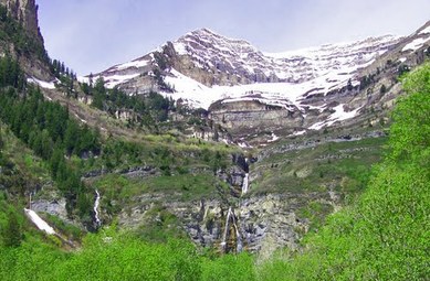
Stewart Falls Utah
Off the backside of Mount Timpanogos lies Iceberg thats runoff produces Stewart Falls. A one and a half mile hike in the scenic Wasatch Mountains near Sundance Mountain Resort leads to the icy cold waters that await you. Go ahead and walk under the falls, that is if you enjoy the the sensation mind numbing chills. Walk out the other side and take a few minutes to catch you stolen breath before you fill up your water bottle with the crystal clear ice water from the falls. Don't worry about the heat of summer on your hike back down just enjoy the beautiful scenery as your clothes slowly dry.
Off the backside of Mount Timpanogos lies Iceberg thats runoff produces Stewart Falls. A one and a half mile hike in the scenic Wasatch Mountains near Sundance Mountain Resort leads to the icy cold waters that await you. Go ahead and walk under the falls, that is if you enjoy the the sensation mind numbing chills. Walk out the other side and take a few minutes to catch you stolen breath before you fill up your water bottle with the crystal clear ice water from the falls. Don't worry about the heat of summer on your hike back down just enjoy the beautiful scenery as your clothes slowly dry.
Stewart Falls from Aspen Grove - Orem Utah
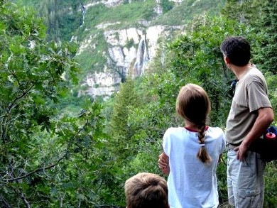
The main trail starts at Aspen Grove with an approximately four mile round trip hike. The hike from Aspen Grove begins above the amphitheater at Theater-in-the-Pines picnic area. It's next to the BYU Aspen Grove Camp on the Provo Canyon North Fork Road. You can also start in the parking lot where the trail that leads to Mt. Timpanogos starts. The trail starts at the far end of the parking lot, heading East. Shortly there after the trail switches back as you head up the ridge (this is the most difficult part of the trail because of the incline. The trail continues and is well marked and easy to find. This parking area also has bathrooms, so make use of them before you start your hike.
The scenery along the route is beautiful. There are a lot of trees and viewpoints along the trail. When you get close to the falls there is a steep section that you go down to the base of the falls. It is worth doing, although you will want to help any young children.
The scenery along the route is beautiful. There are a lot of trees and viewpoints along the trail. When you get close to the falls there is a steep section that you go down to the base of the falls. It is worth doing, although you will want to help any young children.
Ray's Lift to Stewart Falls
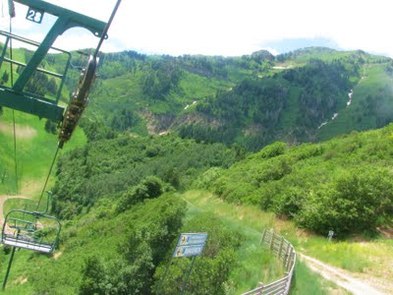
"I love love love riding this ski lift in the Summer and Fall. The views of Timp are spectacular. I think it (along with the hike) would make a most romantic date." Blogger
One trail starts from the top of Ray’s lift at Sundance Ski Resort. Ray’s lift operates during the summer and provides access to hiking and mountain biking trails. Take the lift up to Ray’s Summit and then trek through mountain forest and across the meadow to the falls. Allow 2 hours hiking time.
Stewart Falls is a mildly challenging hike, but there are a few different ways to get to the top of it. One of the more popular ways, especially for families with children, is to take the ski lift up. The ski lift operates May 20 to September 5 from 10AM till 6PM, and September 6 to October 16 from Noon till 5PM. For adults, the cost is $11 per ride; for children, the cost is $9. From the top of the ski lift, you then start the hike to Stuart falls. I’ve seen a lot of kids playing in the water at the falls so, if you dare, wear a swimsuit! The water is extremely cold—parents beware!—but the view of the mountains and the valley below is quite worth it. Remember to bring a camera!This hike is a loop so after crossing the falls you will continue on a single track downwards. You will pass several gorgeous and intersting homes on the way down.
Stewart Falls from Sundance Resort
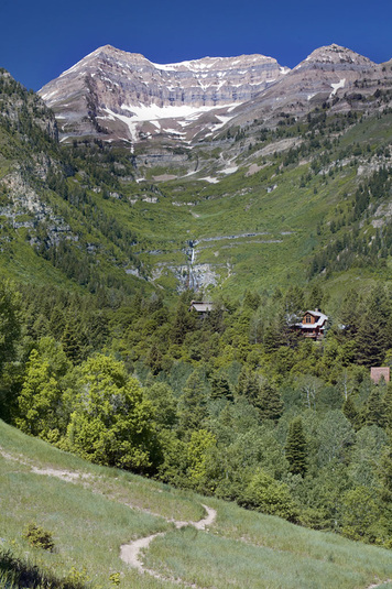
The trailhead starts out going along the east ridge above some of the buildings at Sundance. The trail stays along the ridge for a few hundred yards and then crosses the road. Right before you cross the road the path gets a little muddy from a natural spring in this area. Once you cross the road there is a little foot bridge that crosses the stream running down from the falls. The trail will then switchback up the other side of the ridge through a grove of trees. Once you pass the grove the flora opens up and you can start to get some glimpses of the destination. As you follow the path in this area you will see 3 or so beaver dams along the river which is almost surreal as it is surrounded by the Sundance Cottages (you may even see a movie star or two up here sitting on the decks of the cottages). Right past the beaver dams you will come to Stewart Meadow. If you have time it is worth to go walking in this meadow as the stream meanders through the meadow making it lush. Wild Mint is plentiful along the meadow all the way up to the falls, you can tell by the smell and the stem of the plant is square shaped. As you get closer to the falls, you will notice the temperature starts to drop as the water falling from the cascade acting like a giant swamp cooler. From here, the trail has little elevation gain. Once you reach the falls you will see at least 3 different tiers to the cascade and see why it is one of the best kept secrets in the area.
Length:3.00 milesDifficulty:Moderately StrenuousEstimated Hike Time:1 HourTrail Type:Out and BackElevation Low:6,093 feetElevation High:6,980 feetTotal Elevation Gain:887 feet
http://trails360.com/hikes/view/stewart_falls_via_sundace_resort
Length:3.00 milesDifficulty:Moderately StrenuousEstimated Hike Time:1 HourTrail Type:Out and BackElevation Low:6,093 feetElevation High:6,980 feetTotal Elevation Gain:887 feet
http://trails360.com/hikes/view/stewart_falls_via_sundace_resort
Stewart Falls Utah
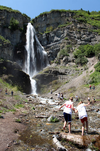
"One of the most popular hikes is Stewart Falls, which provides a stroll through green forests and meadows to a large waterfall. I’ve also heard tell of a myth, which I received from a darling old man while sitting near the falls with my date, that if you make it to the other side of the waterfall run-off, you are automatically married! But, there’s a catch. You cannot touch the water! Try and figure that one out." Blogger
"This cavalcade of waterfalls runs almost year-round as melt-off from the backside of Timpanogas, Utah Valley’s most majestic mountain. The drive to the trailhead alone merits the trip; leave plenty of time for scenic stops. The path of the easy, 2-mile hike is choked with aspen, pine, and oak of all colors–the flora itself a cascade of paint: burnt reds, yellows, and bright greens. A quick dip in the natural pool at the foot of the falls is as refreshing as the mountain air. Be sure to have a camera in tow—you're going to want to play Ansel Adams." Blogger
Getting to Stewart Falls Utah
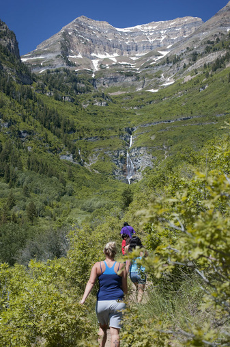
From I-15 take Exit 275 (UT State Road #52 or 800 north in Orem). Go east 3.5 miles to Provo Canyon to US 189. Follow the left turn left onto US 189 into Provo Canyon. Continue up Provo Canyon for 7 miles to Sundance Ski Resort turnoff (UT State Road #92). The turn to Sundance is just after to pass through and small tunnel. Turn left onto UT 92 continue up for 5 or 6 miles either to the Sundance Ski Area. If you are choosing to ride Ray’s Lift to the trailhead then park in the resort parking and make you way to Ray's Lift.
If you are choose the trail starting from Aspen Grove then follow the road past Sundance and the BYU facilities. There is a campground located on the south side of the road by the fee station for the Alpine Loop. The trailhead parking lot for the Aspen Grove Trailhead is located west of the campground.
If you are choose the trail starting from Aspen Grove then follow the road past Sundance and the BYU facilities. There is a campground located on the south side of the road by the fee station for the Alpine Loop. The trailhead parking lot for the Aspen Grove Trailhead is located west of the campground.
Provo Canyon Realtor
Denise Martin
Orem's Nicest Realtor This website is brought to you by Denise Martin, known as Orem's Nicest Realtor. It would be our pleasure to help you buy or sell a condo in Provo or Orem and surrounding areas. Denise Martin Orem's Nicest Realtor SoldByDenise.com [email protected] RealtyPath Professionals 1815 N 1120 W Provo, UT 84604 |
Search Provo Canyon Real Estate |
