Cascade Saddle Trail - Trails in Provo Utah
Cascade Saddle Utah Trail
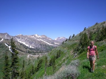
Hiking the Cascade Saddle Utah
Cascade Saddle Trail
Courtesy of 100 Hikes in Utah
Length: 11.5 total miles
Distance to Saddle: 5 Miles from Big Springs Park
Starting Elevation: 5,130 Feet
Saddle Elevation: 9,650
Peak Elevation: 10,761
Elevation Gain: 3,930 feet
Trail Type: Out-and-back
Skill Level: Strenuous
Duration: 6 to 8 hours
Season: July to October
Cascade Saddle Trailhead - South Fork Canyon
Trailhead to Cascade Saddle Utah
Cascade Saddle Trailhead at Big Springs Park
Big Springs Park is located near the top of South Fork Canyon Road. From the mouth of Provo Canyon, travel east up Provo Canyon Road to Vivian Park (approx. 8 miles.) Turn right onto South Fork Road, past Vivian Park, past Giles Ranch, Past South Fork Park, and on to Big Springs Park (approx 2.5 miles.) The hike to Cascade Saddle starts at the Big Springs Park's upper (west-most) parking lot on the north-side.
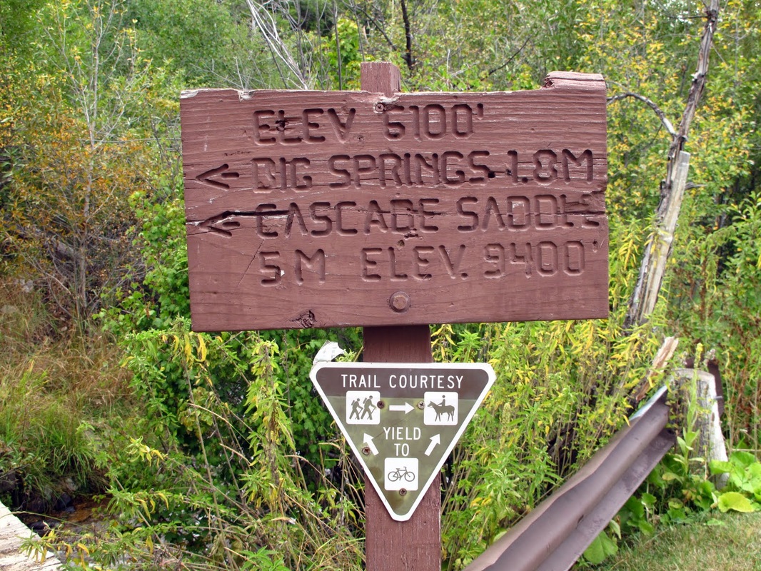
After crossing a footbridge, you will see a sign stating it is 1.8 miles to Big Springs and 5 miles to Cascade Saddle.
Big Springs Park is located near the top of South Fork Canyon Road. From the mouth of Provo Canyon, travel east up Provo Canyon Road to Vivian Park (approx. 8 miles.) Turn right onto South Fork Road, past Vivian Park, past Giles Ranch, Past South Fork Park, and on to Big Springs Park (approx 2.5 miles.) The hike to Cascade Saddle starts at the Big Springs Park's upper (west-most) parking lot on the north-side.
After crossing a footbridge, you will see a sign stating it is 1.8 miles to Big Springs and 5 miles to Cascade Saddle.
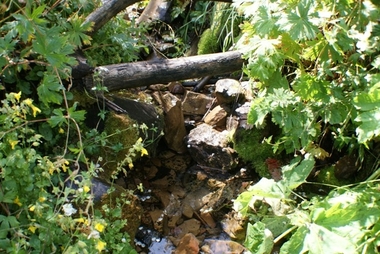
At Big Spring, a rope and tire swing out over a pool in the stream and there are several concrete pads, which are remnants from when the spring served as a scout camp. The trail concinues to parallel the stream up a draw, until it crosses Big Springs Hollow. From there it follows another side drainage to the right.

As the trail steepens, you will see signs of the frequent avalanches that prevent trees from attaining any significant size. At about 1.5 miles from Big Spring, you will arrive at the top of an intermediate ridge (marked 7666 on the USGS map) a gain of over 1200 feet from the springs.
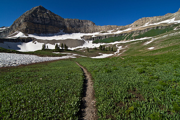
The destination of the saddle is now visible, however, you still have another 1900 feet to climb in the next 1.5 miles. The climb through a series of small alpine bowls is beautiful, although the steepness of the trail may prevent you from fully appreciating it. The last 1/2 mile feels straight up, but the ridge top view is breathtaking. You are able to see much of Utah Valley to the east and the Uinta Mountains to the west.
Cascade Terraces
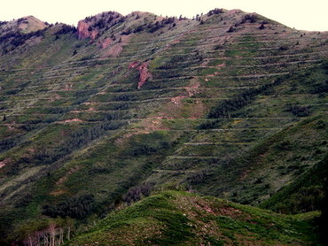
There was a sign that talked about terraces that were hand dug after a forest fire to prevent erosion. You can see them for about a mile radius. Looks like a lot of work.
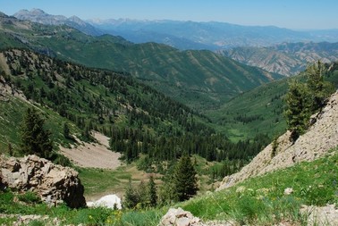
"As the three of us continued higher, we were constantly amazed by the views, and the solitude. A few times we heard mountain goats, and on one of our breaks we were astonished by the plethora of dragon flies hovering at such a high altitude. As we continued route finding in a northeast direction we eventually reach a plateau giving way to views over looking Rock Canyon and Squaw Peak below. At this point we turned west for a few yards, and scrambled up to the main ridge that would lead us northward to the south summit. We arrive at the South Peak (10,761 ft) at 2:45 pm. From the saddle to the peak we found that staying on the ridge as much as possible was the easiest and safest route.
The views looking west were amazing and allowed us to look down on Squaw Peak and Rock Canyon. I was of the opinion that the view of Utah Lake was the best I had ever seen. To the northeast we could see Deer Creek reservoir and to the south we easily identify Shingle Mill, Provo Peak, and Nebo mountains." Blogger
The views looking west were amazing and allowed us to look down on Squaw Peak and Rock Canyon. I was of the opinion that the view of Utah Lake was the best I had ever seen. To the northeast we could see Deer Creek reservoir and to the south we easily identify Shingle Mill, Provo Peak, and Nebo mountains." Blogger
Provo Canyon Realtor
Denise Martin
Orem's Nicest Realtor This website is brought to you by Denise Martin, known as Orem's Nicest Realtor. It would be our pleasure to help you buy or sell a condo in Provo or Orem and surrounding areas. Denise Martin Orem's Nicest Realtor SoldByDenise.com [email protected] RealtyPath Professionals 1815 N 1120 W Provo, UT 84604 |
Search Provo Real Estate |
