Bonneville Shoreline Trail - Hikes in Utah - Provo Utah
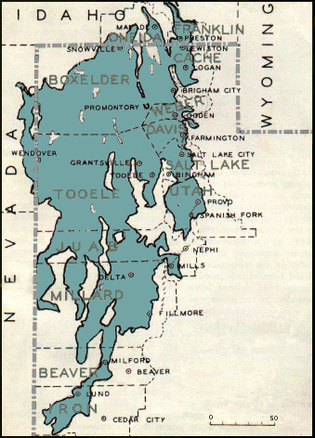
The Bonneville Shoreline Trail (BST) will one day stretch from the Idaho border to Nephi, more than 280 miles. Currently just over 100 miles of the route is officially designated as part of the BST. The route attempts to follow the bonneville bench that was formed by the ancient lake. The Bonneville Shoreline Trail has been designated as Utah's Millennium Legacy Trail, as part of a White House initiative on the basis of our Governor's recommendation. The Utah Legislature has recognized the trail during the 1999 General Session. The vision of the BST is a non-motorized trail that serves as an interface between the urban area and public lands along the Wasatch Front and will provide trail users with a recreational experience at a distance from motorized activities that is both safe and aesthetically pleasing.
Courtesy of the Bonneville Shoreline Trail Coalition
Courtesy of the Bonneville Shoreline Trail Coalition
Ancient Bonneville Lake Shoreline in Utah
The Bonneville Shoreline Trail Follows an Ancient Shoreline
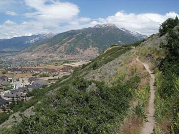
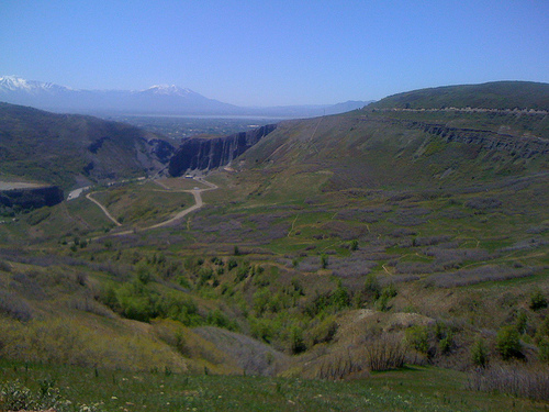
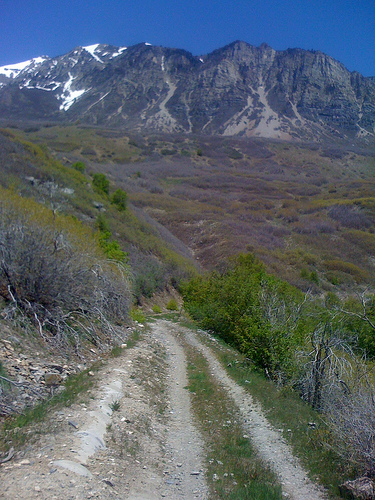
The trail follows the eastern shoreline of ancient Lake Bonneville. Lake Bonneville filled the Great Basin which covers much of the western United States. The lake existed in the late pleisteine period when Utah was a much wetter place and glaciers sat nestled in the peaks of the Wasatch Range. The Lake created a series of benches as it slowly receded into the desert over thousands of years. Many of Utah’s cities are built on the lower benches and the Bonneville Shoreline trail follows the upper benches.
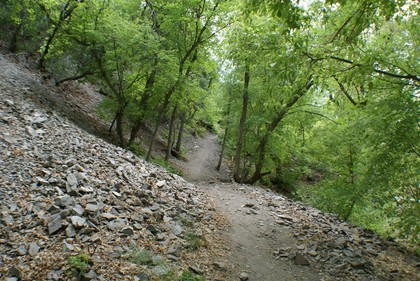
A route around a lake shore may sound like a gentle path, but the Bonneville shoreline is not. In the thousands of years since the lake evaporated and left its child the Great Salt Lake in the valley the rivers and streams running from the mountains have cut canyons and ravines across the once even shore. The trail continuously descends into and climbs out of these obstacles along its route.
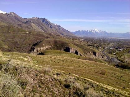
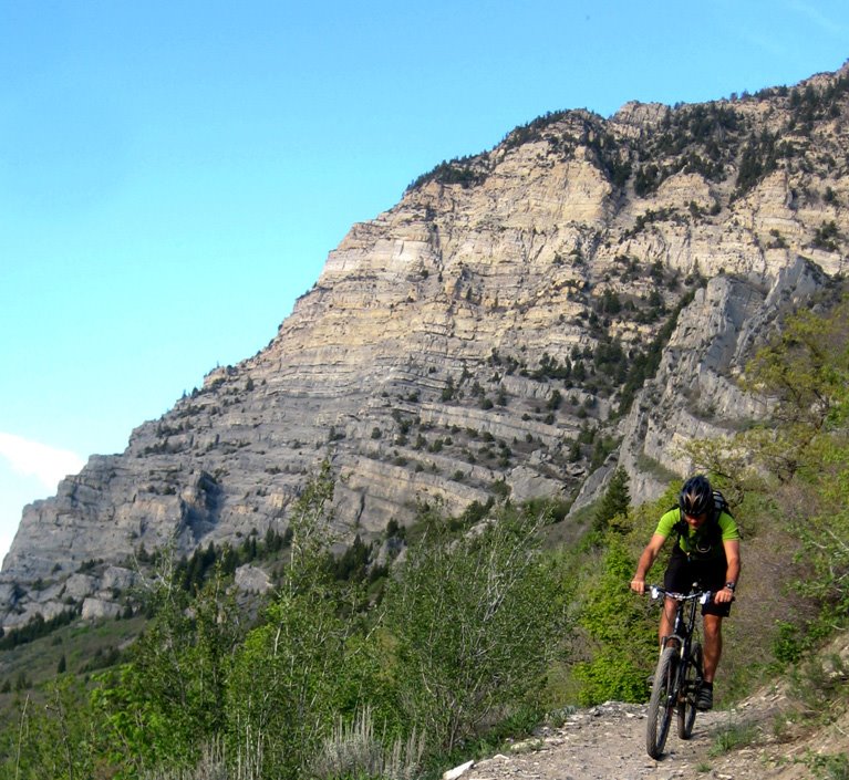
The Bonneville Shoreline Trail runs on top of the Wasatch fault for most of its route. The Wasatch fault is still active, pushing the peaks of the Wasatch Range higher. The most obvious sign of the fault is the escarped ridge faces that border much of the trail.
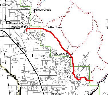
Bonneville Shoreline Trail in Utah County
Trail Miles Proposed Constructed to Date
69 30
The trail follows the eastern shoreline of ancient Lake Bonneville. Lake Bonneville filled the Great Basin which covers much of the western United States. The lake existed in the late pleisteine period when Utah was a much wetter place and glaciers sat nestled in the peaks of the Wasatch Range. The Lake created a series of benches as it slowly receded into the desert over thousands of years. Many of Utah’s cities are built on the lower benches and the Bonneville Shoreline trail follows the upper benches.
A route around a lake shore may sound like a gentle path, but the Bonneville shoreline is not. In the thousands of years since the lake evaporated and left its child the Great Salt Lake in the valley the rivers and streams running from the mountains have cut canyons and ravines across the once even shore. The trail continuously descends into and climbs out of these obstacles along its route.
The Bonneville Shoreline Trail runs on top of the Wasatch fault for most of its route. The Wasatch fault is still active, pushing the peaks of the Wasatch Range higher. The most obvious sign of the fault is the escarped ridge faces that border much of the trail.
Bonneville Shoreline Trail in Utah County
Trail Miles Proposed Constructed to Date
69 30
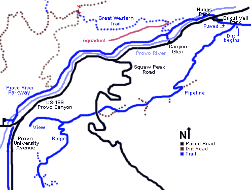
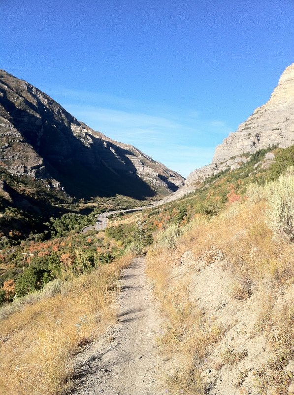
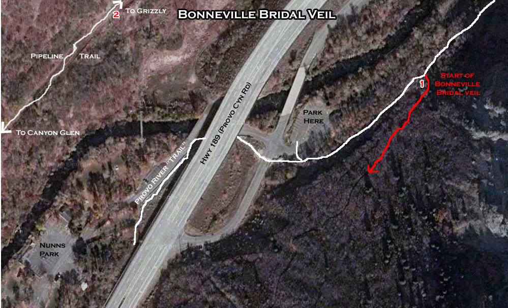
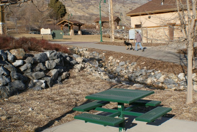
Bridal Veil Falls Trailhead
The Bonneville Shoreline Trailhead at Bridal Veil Falls
The trail starts on the Provo River Parkway, between the Bridal Veil Park parking lot and Bridal Veil Falls. About 0.1 mile up the paved path, look for the Bonneville Shoreline sign and a singletrack on your right. It's a fairly steady climb, gaining about 500 feet over the first mile.
After the initial climb, the trail intersects the southern pipeline. Here, the trail flattens and winds around the hillside, generally staying over or near the pipeline. Some short sections will be doubletrack. The trail is intersected by multiple ATV and doubletracks. When in doubt, look around for the most flat trail -- if you're making a stiff climb or descent at this point, you're off the pipeline trail.
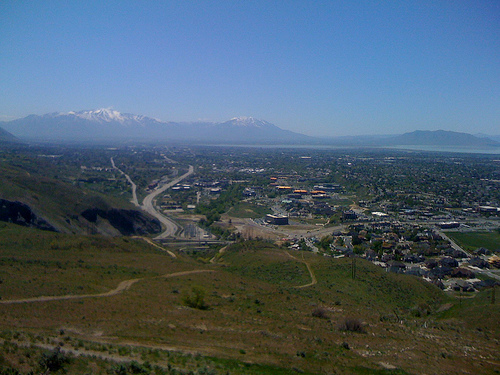
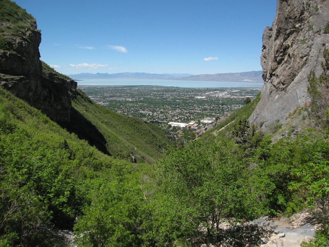
The sideslope is quite steep, and there are occasional rough sections that might make beginners nervous. During the climb, you'll be riding through gamble oak, maple, currant, oregon grape, and an occasional pine.As you come around the mountain onto the old Lake Bonneville gravel deposits, the scenery turns to dry grass, brush, and short scrub oak. Now you can look down towards Utah Valley, and up Provo Canyon.At around 2.5 miles (GPS N 40° 18.771' W 111° 38.355'), the new singletrack climbs up over the ridge to your left. Note the spot, but continue on the pipeline trail out to the viewpoint 1/2 mile later. Say "Oooh, Awww." Then if you want more riding, come back to the singletrack and climb. After crossing the ridge, the singletrack dumps onto an ATV trail with multiple branches. If you continue to select the most flat trail, you'll arrive on top of a buried water tank overlooking northern Provo's homes, stables, and corrals.
The trail starts on the Provo River Parkway, between the Bridal Veil Park parking lot and Bridal Veil Falls. About 0.1 mile up the paved path, look for the Bonneville Shoreline sign and a singletrack on your right. It's a fairly steady climb, gaining about 500 feet over the first mile.
After the initial climb, the trail intersects the southern pipeline. Here, the trail flattens and winds around the hillside, generally staying over or near the pipeline. Some short sections will be doubletrack. The trail is intersected by multiple ATV and doubletracks. When in doubt, look around for the most flat trail -- if you're making a stiff climb or descent at this point, you're off the pipeline trail.
The sideslope is quite steep, and there are occasional rough sections that might make beginners nervous. During the climb, you'll be riding through gamble oak, maple, currant, oregon grape, and an occasional pine.As you come around the mountain onto the old Lake Bonneville gravel deposits, the scenery turns to dry grass, brush, and short scrub oak. Now you can look down towards Utah Valley, and up Provo Canyon.At around 2.5 miles (GPS N 40° 18.771' W 111° 38.355'), the new singletrack climbs up over the ridge to your left. Note the spot, but continue on the pipeline trail out to the viewpoint 1/2 mile later. Say "Oooh, Awww." Then if you want more riding, come back to the singletrack and climb. After crossing the ridge, the singletrack dumps onto an ATV trail with multiple branches. If you continue to select the most flat trail, you'll arrive on top of a buried water tank overlooking northern Provo's homes, stables, and corrals.
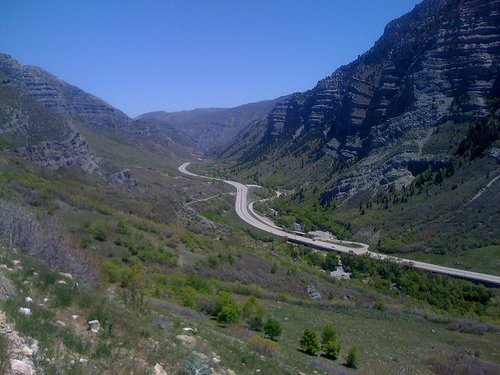
Provo Canyon Entrance Trailhead
The Bonneville Shoreline Trailhead at Provo Canyon
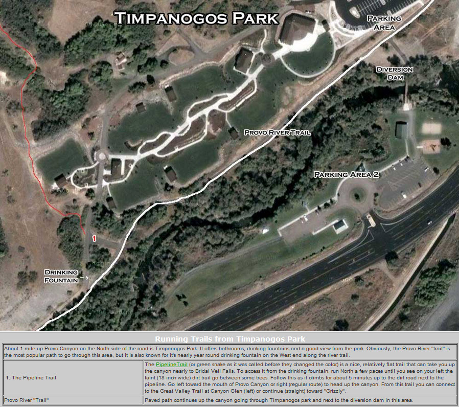
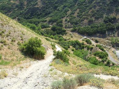
This is a great way to run Provo Canyon from the mouth and avoid some of the harshness of the paved (i.e. evil!) river trail. You will notice right from the start a 1 foot wide dirt path on the right side until you come to the first bridge, you may even follow that path up to the pipe that crosses the river and run across the pipe instead of the bridge! After the river crossing the dirt trail breaks off about 30 feet to the right and continues for over a 1/4 mile. As it comes back to the paved river trail you come to the little (15 ft. long) bridge. Cross the trail and go left just before the bridge and you will find yourself running straight up the rocky river bed that heads toward the sometimes there waterfall that comes from the pipeline. After 1 or 200 meters, you will see the dirt singletrack trail on the right hand side. Take this trail all the way to the first drinking fountain on the river trail which is just before Mt. Timpanogas park. Now instead of heading up the river trail, go up the path that leads in to the park, after 60 or 80 meters you will see the trail break off to the left. This will take you on a 4-6 minute easy climb which will take you up to the pipeline road (UNPAVED!-soapbox-why is the paved river trail called a trail and the unpaved pipeline trail called a road?) Follow the pipeline road all the way to where it drops down to Canyon Glen Park where you can get some water at the drinking fountain there. This is just over 3.5 miles to this point. (For an all dirt route, turn around and go back the way you came.) For the 6.5 mile version, run down the river trail all the way to the mouth. To get it closer to seven and to get more dirt in, turn off on to the very dirt section you started on when you get to the Mt. Timpanogas park drinking fountain.
This is a great way to run Provo Canyon from the mouth and avoid some of the harshness of the paved (i.e. evil!) river trail. You will notice right from the start a 1 foot wide dirt path on the right side until you come to the first bridge, you may even follow that path up to the pipe that crosses the river and run across the pipe instead of the bridge! After the river crossing the dirt trail breaks off about 30 feet to the right and continues for over a 1/4 mile. As it comes back to the paved river trail you come to the little (15 ft. long) bridge. Cross the trail and go left just before the bridge and you will find yourself running straight up the rocky river bed that heads toward the sometimes there waterfall that comes from the pipeline. After 1 or 200 meters, you will see the dirt singletrack trail on the right hand side. Take this trail all the way to the first drinking fountain on the river trail which is just before Mt. Timpanogas park. Now instead of heading up the river trail, go up the path that leads in to the park, after 60 or 80 meters you will see the trail break off to the left. This will take you on a 4-6 minute easy climb which will take you up to the pipeline road (UNPAVED!-soapbox-why is the paved river trail called a trail and the unpaved pipeline trail called a road?) Follow the pipeline road all the way to where it drops down to Canyon Glen Park where you can get some water at the drinking fountain there. This is just over 3.5 miles to this point. (For an all dirt route, turn around and go back the way you came.) For the 6.5 mile version, run down the river trail all the way to the mouth. To get it closer to seven and to get more dirt in, turn off on to the very dirt section you started on when you get to the Mt. Timpanogas park drinking fountain.
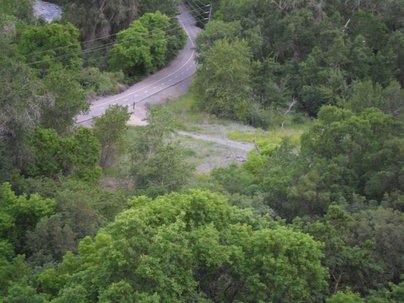
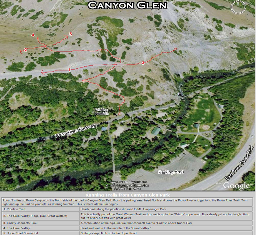
Canyon Glen Park Trailhead
The Bonneville Shoreline Trailhead at Canyon Glen Park
Riding uphill from Canyon Glen, take the first right turn to switch back. Arriving at the pipe, go east 20 feet past it and find the trail that heads uphill to the west. Immediately on top of the ridge, take the left fork in the trail (the right fork dead-ends in the shallow valley on the other side of the ridge). When you reach double-track, turn right, then turn left onto the Bench Road when you reach the second gate. Riding this direction, there are some steep loose uphills on ST, OK for experts but tough for everybody else.
Then I climbed (kind of) the Cliff trail. Way easier to go down than up. I almost made the first steep climb, but spun out on some lose stuff. Up on the cliff edge trail I just didn't have the nerve and stopped a few times to walk past the exposed sections. Going down you have gravity working to help you roll through the nasty spots, but going up if you stutter pedaling it could be bad. Eh, it was fun to try.
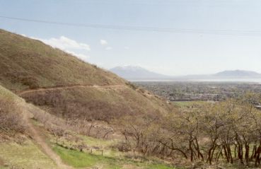
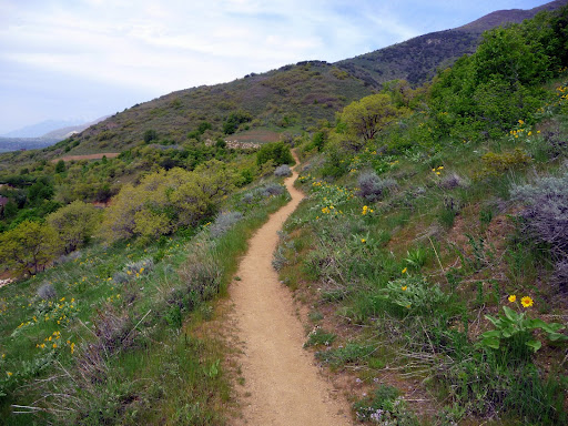
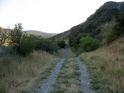
Orem to Pleasant Grove (Provo Canyon to Battle Creek)
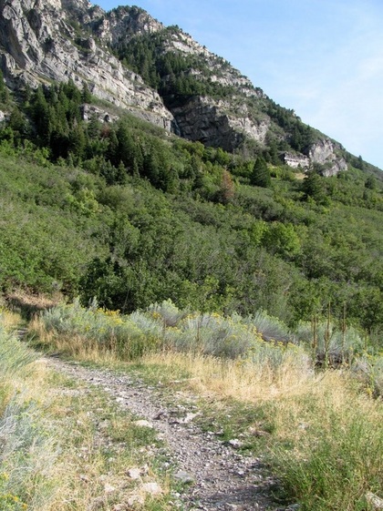
The Bonneville Trail from Orem to Pleasant Grove
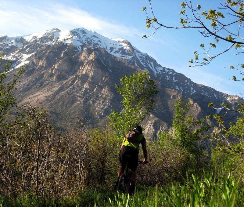
This section of the Bonneville Shoreline trail connects the mouth of Provo Canyon to Battle Creek Canyon in Pleasant Grove. It's a nice 4.5-mile hike with expansive views of Utah Valley. There are some sections where the side-slope is steep and will make kids and beginners nervous.
The trail has 650 feet of elevation gain, starting at around 5100 feet. The elevation climb is necessary from whichever trailhead you use.
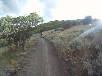
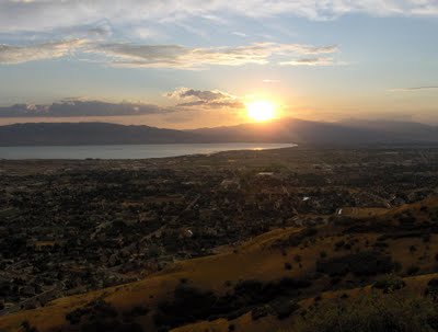
The surface is mostly dirt, but there are some areas towards the Orem end where there's talus (broken rock). The trail is quick and fun to ride, even if the scenery along the trail is relatively non-inspiring. This is foothill scrub, typical for the western slope of the Wasatch. You'll ride through grass with occasional sagebrush and isolated stands of scrub oak. On a clear day, the views over the valley are nice, as you try to identify "what's what."
The point of this ride is that it's close to civilization. You can easily hit this trail before or after work. And it's ready to ride a couple of months before snow clears from the canyon trails. The singletrack trail was in great shape and well-maintained when I rode it. There's an alternate route that takes you though a maze of interconnecting doubletrack on the Pleasant Grove end -- a rutted playground of ecological vandalism awash with shotgun shells, broken glass, and beer cans.
Large boulders had just been moved into position to enforce the "no motor vehicles" rule, so you should find things a bit prettier on the "alternate route" in the future. Most sections of this trail will clear of snow by mid-March, although there will still be occasional snowstorms. Some muddy sections will persist until May. In some years, horse riders may post-hole the trail rather severely by riding in early spring while portions remain deeply wet.
Most riders do this as a 9-mile out-and-back. But you can close a loop with city streets, or do a short loop via the Dry Creek trailhead.
This section of the Bonneville Shoreline trail connects the mouth of Provo Canyon to Battle Creek Canyon in Pleasant Grove. It's a nice 4.5-mile hike with expansive views of Utah Valley. There are some sections where the side-slope is steep and will make kids and beginners nervous.
The trail has 650 feet of elevation gain, starting at around 5100 feet. The elevation climb is necessary from whichever trailhead you use.
The surface is mostly dirt, but there are some areas towards the Orem end where there's talus (broken rock). The trail is quick and fun to ride, even if the scenery along the trail is relatively non-inspiring. This is foothill scrub, typical for the western slope of the Wasatch. You'll ride through grass with occasional sagebrush and isolated stands of scrub oak. On a clear day, the views over the valley are nice, as you try to identify "what's what."
The point of this ride is that it's close to civilization. You can easily hit this trail before or after work. And it's ready to ride a couple of months before snow clears from the canyon trails. The singletrack trail was in great shape and well-maintained when I rode it. There's an alternate route that takes you though a maze of interconnecting doubletrack on the Pleasant Grove end -- a rutted playground of ecological vandalism awash with shotgun shells, broken glass, and beer cans.
Large boulders had just been moved into position to enforce the "no motor vehicles" rule, so you should find things a bit prettier on the "alternate route" in the future. Most sections of this trail will clear of snow by mid-March, although there will still be occasional snowstorms. Some muddy sections will persist until May. In some years, horse riders may post-hole the trail rather severely by riding in early spring while portions remain deeply wet.
Most riders do this as a 9-mile out-and-back. But you can close a loop with city streets, or do a short loop via the Dry Creek trailhead.
Nunn's Park Trailhead
The Bonneville Shoreline Trailhead at Nunn's Park
This makes the ride about a mile longer, but at the expense of a rather ugly short section of trail from Nunn's park up to the aqueduct. Going up-canyon, turn right 4 miles up the canyon, then left under 89. Go into Nunn's Park. On your bike, come back through the park entrance, then turn left on a broken-up roadway just before the road goes under 89. Turn left at the fence and follow the fence uphill. This section is a hike-a-bike uphill. Downhill, it's tricky because if you slide or bobble you're going to hit the fence. As the singletrack reaches the top, go left (down-canyon).
This makes the ride about a mile longer, but at the expense of a rather ugly short section of trail from Nunn's park up to the aqueduct. Going up-canyon, turn right 4 miles up the canyon, then left under 89. Go into Nunn's Park. On your bike, come back through the park entrance, then turn left on a broken-up roadway just before the road goes under 89. Turn left at the fence and follow the fence uphill. This section is a hike-a-bike uphill. Downhill, it's tricky because if you slide or bobble you're going to hit the fence. As the singletrack reaches the top, go left (down-canyon).
|

|
|
|
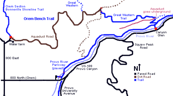
American Fork to Santaquin ( Miles)Trail Description
Provo Canyon Trailhead (3.5 Miles -paved)The trail follows the Provo River Parkway, a paved recreation trail up the canyon for 3.5 miles to Bridal Veil Falls.
Bridal Veil Falls Trailhead (6.3 Miles -dirt)From the Bridal Veil Falls parking lot continue up the Provo River Parkway for .1 mile to where the single track breaks off on your right. The trail climbs steadily, gaining about 500 feet in the first mile. The trail then intersects with a pipeline and is relatively flats as it winds around the hills. Don't take any intersecting trails that climb or decsend just continue flat. About 2.5 miles from the parking lot a single track climb to the left. You can continue straight on the flat for a view but come back and take this single track over the hill. It goes through a maze of intersecting ATV trails and finally reaches a burried water tank. Climb a dirt road and then follow it south above orchard and then climb again above a park in order to get above a cluster of homes on the hillside. Descend toward the homes and exit onto Aspen Ridge Lane.
Aspen Ridge Trailhead (2.6 Miles -paved)Descend Aspen Ridge Lane to Hillside Circle, go south onto Windsor Dr, turn left on Windsor and follow it south. At Foothill Drive continue south to Paiute Drive, go south on Paiute Drive until you can enter the pipline road on the left. Follow the pipeline to Rock Canyon.
Rock Canyon Trailhead (1.75 Miles -dirt)Climb Rock Canyon for .2 miles and then take a path on the south side of the road that climb west to the pipeline. Follow the pipeline southe to Y Mountain.
"Y" Mountain Trailhead (1.6 Miles -dirt)Continue south along the pipeline for .5 miles then climb a single track into Slate Canyon.
Slate Canyon Trailhead (1.25 Miles -dirt)Climb south out of Slate Canyon, pass below the gravel pit and drop onto the pipeline. Take the path above and parallel to the pipeline south, this path drops onto the pipeline near Oregon Avenue.
Orem Homes for Sale Denise Martin - Utah Realtor
Denise Martin
Orem's Nicest Realtor This website is brought to you by Denise Martin, known as Orem's Nicest Realtor. It would be our pleasure to help you buy or sell a condo in Provo or Orem and surrounding areas. Denise Martin Orem's Nicest Realtor SoldByDenise.com [email protected] RealtyPath Professionals 1815 N 1120 W Provo, UT 84604 |
Search Provo Homes for Sale |
