Big Springs Hollow Trail - Provo Canyon Hikes - Provo Utah
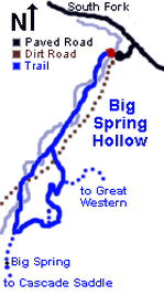
From the South Fork Park trailhead a steady ascent follows a small creek through a broad valley (Hollow) to Big Springs, a natural spring flowing from the mountain side. Mountain views, abundant valley vegetation and frequent wildlife sightings make this a popular and accessible family adventure.
Big Springs Hollow Trail Description
Big Springs Hollow Trail Loop
Courtesy of Greg Witt, 60 Hikes within 60 Miles of SLC
Length: 4.34 miles
Elevation: 5796 ft.
Elevation Gain: 554 feet
Configuration: Loop
Difficulty Level: Easy
Scenery: Mountain views to the west and natural springs with perennial flow. Trail follows creek.
Exposure: Mostly shaded
Traffic: Moderate. Go midweek for more solitude
Trail surface: Dirt, moderate incline
Hiking time: 1.5 to 2.5 hours
Water requirements: Carry 1 liter. Water at springs is generally safe at the source.
Season: Year round. Ideal snowshoe or ungroomed cross-country ski trail in winter.
Access: Hikable year round. No fees for parking or park access.
Facilities: Restrooms and drinking water are available in the park. Closed in winter.
Dogs: Permitted on leash
Comments: Some areas may become boggy in spring. Negligible avalanche risk in winter.
Peace, Beauty, Nature, & Fresh Air
Seclusion and Scenery:
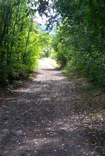
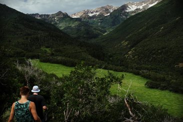
Take everything you ever imagined about a city park—the crowds, passing cars, cityscapes. Now throw it all out the window. True, the land in Big Springs Hollow is largely owned by the city of Provo, and the trailhead starts in the city's Big Spring Park's parking lot. But within less than 60 seconds, the parking lot is out of sight and suddenly you’re enveloped in a secluded mountain valley in search of the natural springs that feed the meandering creek at your side.
Throughout the hike, quaking aspens and big tooth maple provide most of the shade, while thickets of Poplar, River Birch, and Willows cluster near the creek.
Hike Alongside Meandering Creeks
Criss-crossing the Creek:
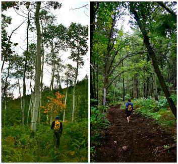
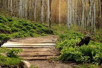
The main trail follows the south side of this wide slope-sided valley as the creek criss-crosses the trail repeatedly. Sturdy wooden bridges span all of the major creek crossings. For the first 0.7 miles the trail makes a moderate but steady climb, finally arriving at a knoll where the terrain flattens out a bit. After a brief 0.1 mile of level trail, the slope steepens and the ascent returns. Mountain views of Cascade Peak and the backside of the Wasatch front remain ahead of you to the west for most of the hike.
The main trail follows the south side of this wide slope-sided valley as the creek criss-crosses the trail repeatedly. Sturdy wooden bridges span all of the major creek crossings. For the first 0.7 miles the trail makes a moderate but steady climb, finally arriving at a knoll where the terrain flattens out a bit. After a brief 0.1 mile of level trail, the slope steepens and the ascent returns. Mountain views of Cascade Peak and the backside of the Wasatch front remain ahead of you to the west for most of the hike.
Multi-Use Trail for All Users
Multi-Use Trail Including Motorized Vehicles:
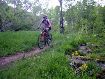
The trail is designated as a non-motorized multi-use trail, with horses, mountain bikers, hikers and winter snowshoers and skiers sharing the trail. They all seem to get along pretty well under the trail’s moderate usage. Hikers still predominate in summer and snowshoers in winter. The gentle side slopes of the valley make avalanche risk negligible. There is no history or visible evidence of avalanches in the area around the trail.
The trail is designated as a non-motorized multi-use trail, with horses, mountain bikers, hikers and winter snowshoers and skiers sharing the trail. They all seem to get along pretty well under the trail’s moderate usage. Hikers still predominate in summer and snowshoers in winter. The gentle side slopes of the valley make avalanche risk negligible. There is no history or visible evidence of avalanches in the area around the trail.
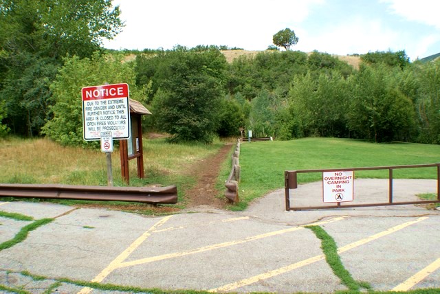
Big Springs Park Trailhead
Weather:
Weather can change rapidly on the eastern slopes of the Wasatch. Particularly in the fall and winter, once the sun sets or the clouds roll in, afternoon temperatures can drop quickly.
Directions to the Trail:
Big Springs Park is located near the top of South Fork Canyon Road. From the mouth of Provo Canyon, travel east up Provo Canyon Road to Vivian Park (approx. 8 miles.) Turn right onto South Fork Road, past Vivian Park, past Giles Ranch, Past South Fork Park, and on to Big Springs Park (approx 2.5 miles.) The hike to Cascade Saddle starts at the Big Springs Park's upper (west-most) parking lot on the north-side.
Big Springs Trailhead

Big Springs and Cascade Saddle Trailhead
Trailhead to Big Springs and Cascade Saddle
The first sign you see points 1.8 miles to Big Springs and 5 miles to Cascade Saddle. Cross the wooden bridge and head to the left (west)
The first sign you see points 1.8 miles to Big Springs and 5 miles to Cascade Saddle. Cross the wooden bridge and head to the left (west)
Left to Big Springs at the First Fork
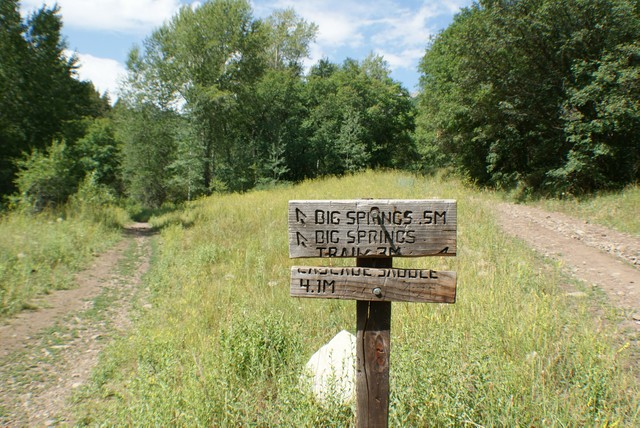
First Fork in the Trail:
Following 30 minutes of steady hiking and immediately after a creek crossing, you will reach a sign marking a fork in the trail. To the left, another 0.5 miles ahead, is Big Springs. The fork to the right leads to the Cascade Saddle at 4.1 miles. Just after taking the trail’s left fork you’ll cross the creek over a wooden bridge. By the time you reach the sign, you’ve gained nearly 500 feet in elevation since leaving the trailhead.
If you would like to continue to the Cascade Saddle, you can do so from the springs.
T-Junction: Keep Right to Go to Big Springs
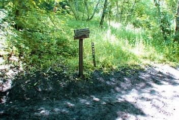
T Junction - Go Right to Big Springs:
Another 0.3 miles beyond the first sign, you’ll come to a second sign at the junction of the Cascade Springs Trail. Turn right at this T junction and continue on toward Big Springs, just 0.2 miles ahead. As you approach Big Springs, the increasingly dense woods become more coniferous with some scrub oak underbrush. The last 0.1 mile before arriving at Big Springs is the steepest section of trail, but not steep enough to require switchbacks or any extreme exertion.
Another 0.3 miles beyond the first sign, you’ll come to a second sign at the junction of the Cascade Springs Trail. Turn right at this T junction and continue on toward Big Springs, just 0.2 miles ahead. As you approach Big Springs, the increasingly dense woods become more coniferous with some scrub oak underbrush. The last 0.1 mile before arriving at Big Springs is the steepest section of trail, but not steep enough to require switchbacks or any extreme exertion.
T-Junction: Go Left to Visit Other Cascade Springs
T Junction - Go Left to Several Other Cascade Springs:
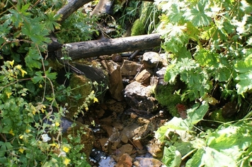
Big Springs is the largest of many small springs, seeps, and willow bogs found throughout the canyon. Several other cascade springs flow from release points on the mountainside near Big Springs and then fan down the slope to the left of the trail. A small water diversion culvert at the right of the trail directs some of the water toward the main creek channel.
The water from the Big Springs outlet, which marks the high elevation point of the hike at 6,350 feet, flows down to South Fork Creek and into the Provo River. Some of the springs in the area have been Provo public water sources for over 60 years.
Continue On the Trail to Loop Back to Big Springs
Follow the Cascade Trail Back to Parking Lot:
From Big Springs, follow the trail down the slope to the right and cross over another wooden bridge. About 0.2 miles past Big Springs the trail merges with the Cascade Trail. This junction represents the turn-around point on the loop. Take a hard right and follow the Cascade Trail east and back to the trailhead parking area. Continuing west on the trail will lead to the Cascade Mountain Saddle and to Rock Canyon Campground.
From this trail junction, ambitious hikers could access a much larger network of trails and actually return to Provo city on foot over the Cascade Mountain Saddle and down Rock Canyon.
Provo School District's Summer Camp Site
Pass-by Provo School District's Summer Camp:
On the return, the north side of the loop passes a permanent camp used by the Provo School District as an environmental camp for elementary students in June. There is a drinking fountain at the site with chlorinated water during the summer. The trail passes wet and dry grassy meadows with lupine, clover, violets and mustards. There’s even a spread of alfalfa that’s cut and harvested by a local rancher.
On the return, the north side of the loop passes a permanent camp used by the Provo School District as an environmental camp for elementary students in June. There is a drinking fountain at the site with chlorinated water during the summer. The trail passes wet and dry grassy meadows with lupine, clover, violets and mustards. There’s even a spread of alfalfa that’s cut and harvested by a local rancher.
Interact With Wildlife in the Uinta National Forest
Nature & Wildlife:
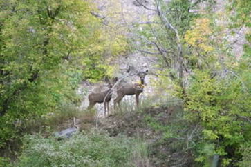
Throughout the year hikers can expect to see deer, rabbits and an occasional moose. Mountain lions roam the hillsides and you will frequently see their tracks in the winter snow, although you’re not likely to actually see this elusive cat. Wild turkey, ruffed grouse and many songbirds can be spotted in the summer. During one recent summer, a survey of butterflies reported 60 different species in Big Springs Hollow between March and September. Western Skippers and Western Blue Tails were the most commonly found species.
Throughout the year hikers can expect to see deer, rabbits and an occasional moose. Mountain lions roam the hillsides and you will frequently see their tracks in the winter snow, although you’re not likely to actually see this elusive cat. Wild turkey, ruffed grouse and many songbirds can be spotted in the summer. During one recent summer, a survey of butterflies reported 60 different species in Big Springs Hollow between March and September. Western Skippers and Western Blue Tails were the most commonly found species.
Orem Homes for Sale Denise Martin, Orem UT Realtor
Denise Martin
Orem's Nicest Realtor This website is brought to you by Denise Martin, known as Orem's Nicest Realtor. It would be our pleasure to help you buy or sell a condo in Provo or Orem and surrounding areas. Denise Martin Orem's Nicest Realtor SoldByDenise.com [email protected] RealtyPath Professionals 1815 N 1120 W Provo, UT 84604 |
Search Provo Real Estate |
