Hiking in Provo Canyon Utah - Provo Canyon Hiking Trails
South Fork Canyon Trailheads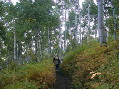 South Fork Canyon Hiking
South Fork Canyon Trailheads
South Fork Park is the trailhead for several hikes in the Wasatch Mountains. Park in the lower or upper parking lots to gain access to the Great Western Trail, Big Springs Hollow, Big Springs, Cascade Saddle, and the Shingle Mill Saddle. "There is a nice, but short, trail near the park that my family uses all the time. We spend a lot of time in Provo Canyon and at least half of that is spent at Big Springs. It's become the go-to area for us. My wife takes the kids up there hiking all the time; the trail is relatively mellow and follows and crosses various streams. It keeps the kids interested and makes it a nice area to go. It's also a great place to go snowshoeing in the winter." Blogger Cascade Saddle Trail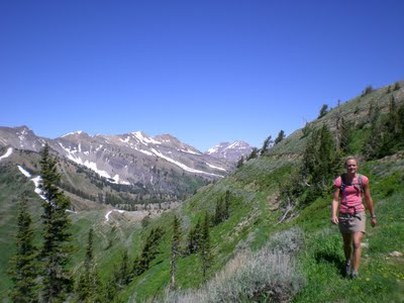
Cascade Saddle Terraces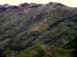
Cascade Saddle Trailhead
Trails Off Provo Canyon Road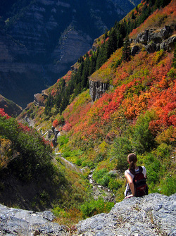
Great Western Trail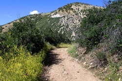
Bonneville Shoreline Trail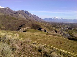
Bonneville Shoreline Trail Loop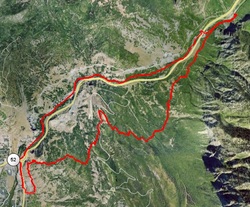
Squaw Peak Trail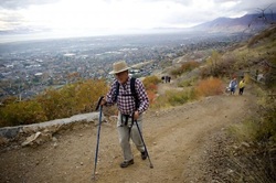
|
Provo River Parkway Trail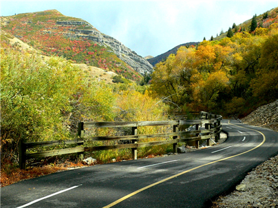 Provo River Parkway Trail Utah
Buffalo Peak Trail
Buffalo Peak Trail Courtesy of Greg Witt, 60 Hikes within 60 Miles of SLC Elevation: 8025 Feet Difficulty: Easy Buffalo Peak is the easiest, most accessible summit on the Wasatch Front. Within minutes of the trailhead you’re overlooking Utah Valley from an elevation of more than 8,000 feet. And you’ll likely have the trail and the summit to yourself. If you were to fill Provo’s LaVell Edwards Stadium to capacity with 65,000 local residents, then ask them where Buffalo Peak is, you might find only a handful who could point it out. From the valley floor, Buffalo Peak is a fairly nondescript rounded knoll, north of the more striking Squaw Peak and west of Cascade Peak. It doesn’t appear in the USGS Geographic Names Information System database, yet at 8,025 feet elevation, it’s higher than many popular peaks on the Wasatch Front. It’s unfortunate this peak has gone unrecognized for so long, because Buffalo Peak stands out as one of the best short hikes in Utah County. You’ll enjoy an easy stroll to some dazzling views, all against the solitude of a mountainous backdrop. At the unmarked trailhead you can park at the side of the dirt road and easily crawl over or under the log fence. You almost feel like you’re sneaking onto private property, but the hike lies within the Uinta National Forest. From the fence, continue up the trail through a grassy meadow sprinkled in spring with violet-blue larkspur and yellow bursts of mulesear wyethia. Deer and cougars visit these dry mountain slopes infrequently. Ground squirrels prove to be more active inhabitants, and with some luck you’ll see a black-headed grosbeak or mountain chickadee. At 100 yards, the trail leaves the grassy clearing and enters a clump of aspen and oak. As the trail continues its gradual ascent, you come to some early partial views of Utah Valley below, with the trail laid out clearly ahead of you. At 0.3 miles, a trail forks to the right, but your summit lies directly ahead. Soon the trail steepens, as the path is sprinkled with chips of shale. The final 0.1-mile push to the summit requires you to negotiate a steep slope of shale and dirt. After just 0.5 miles of walking from the trailhead, you come to the Buffalo Peak summit, a balding shale outcropping crowned with curly-leaf mountain mahogany, maple, and Gambel oak. In autumn, these hillsides take on the look of a patchwork quilt with lemon-colored aspen, fiery maples, and golden oaks. Take in the excellent views stretching from Mount Nebo on the south to the Salt Lake Valley on the north. You overlook Squaw Peak (elevation 7,877 feet) directly to the south, with the summit of Cascade Peak (elevation 10,760 feet) directly to the east, just 1.6 miles away as the crow flies. Directions to the Trail: From Salt Lake City, go south on I-15 to Orem 800 North (Exit 272). At the bottom of the off-ramp, turn left and proceed east. Travel east on 800 North (UT 52) toward the mouth of Provo Canyon for 3.7 miles. Take the left ramp onto East Provo Canyon Road (US 189). Drive 1.8 miles to Squaw Peak Road and turn right. Continue up Squaw Peak Road for 4 miles to the intersection of Squaw Peak Road and Forest Service Road 027. Turn left on FS 027 toward Hope Campground. At 0.4 miles, the pavement ends. Continue on the dirt road for another 2.9 miles to the unmarked trailhead, with a log-rail fence on the right and fire prevention sign on the left side of the road. Sundance Ray's Lift to Stewart Falls
One of the more popular ways, especially for families with children, is to take the ski lift up. The ski lift operates May 20 to September 5 from 10AM till 6PM, and September 6 to October 16 from Noon till 5PM. For adults, the cost is $11 per ride; for children, the cost is $9. From the top of the ski lift, you then start the hike to Stuart falls. I’ve seen a lot of kids playing in the water at the falls so, if you dare, wear a swimsuit! The water is extremely cold—parents beware!—but the view of the mountains and the valley below is quite worth it. Remember to bring a camera!This hike is a loop so after crossing the falls you will continue on a single track downwards. You will pass several gorgeous and intersting homes on the way down.
Stewart Falls Trail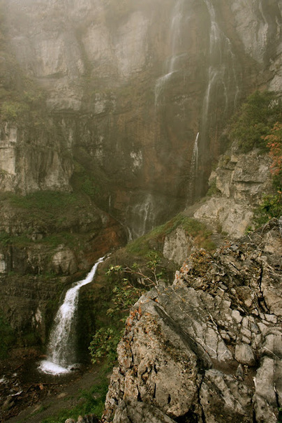
Stewart Falls Trail
Courtesy of Greg Witt, 60 Hikes within 60 Miles of SLC Length: 1.74 miles (one way) Starting Elevation: 6,888 Feet Peak Elevation: 7,215 Elevation Gain: 327 Feet Trail Type: Out-and-back Skill Level: Easy to Moderate Duration: 1 - 2 Hours Season: Year-round - Best in spring thru fall |
Utah County Real Estate Agent
|
Search Provo Utah Property |